
1956 Map of Griffins Corner
USGS Topo · Published 1957About this map
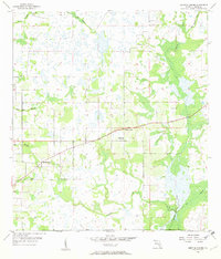
Lemon Grove and Griffins Corner serve as the primary hubs in this mid-1950s survey of Hardee County, Florida. The landscape is dominated by a complex network of wetlands and drainage systems, where Charlie Creek and Little Charlie Creek converge in the north, while Buckhorn Creek and Bee Branch define the southern hydrology. This era represents a period of quiet rural infrastructure in the Florida interior, characterized by section-line roads and scattered agricultural settlements.
Find a feature on this map
12 named features on this map. Tap any name to fly to it.
Don’t see what you’re looking for? This feature index may not catch every label — zoom into the map to look around manually.
Map Details
Editions of this 1956 Griffins Corner Map
4 editions found
Other maps of this area

1953 · Frostproof
USGS Topo · 1:24,000

1953 · Avon Park
USGS Topo · 1:24,000

1953 · Crewsville
USGS Topo · 1:24,000

1955 · Bowling Green
USGS Topo · 1:24,000

1955 · Wauchula
USGS Topo · 1:24,000

1956 · Bereah
USGS Topo · 1:24,000

1956 · Sweetwater
USGS Topo · 1:24,000

1956 · Zolfo Springs
USGS Topo · 1:24,000

1956 · Fort Pierce
USGS Topo · 1:250,000

1958 · Fort Pierce
USGS Topo · 1:250,000