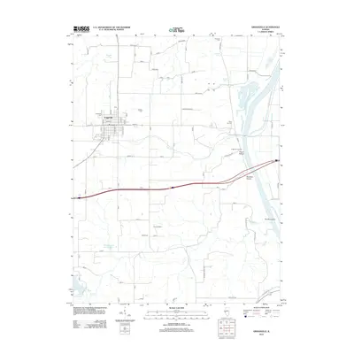
2012 Map of Griggsville
USGS Topo · Published 2012About this map
Griggsville stands as a focal point in Pike County, situated on the high ground west of the Illinois River. The landscape is defined by the sharp transition from the uplands to the river bottom, marked by distinctive terrain features like Church Hollow and Napoleon Hollow. While the town of Griggsville maintains its grid of streets such as Liberty and Stanford, the surrounding rural areas are dotted with family and community legacy sites, including Griggsville Cemetery and Bethel Cemetery.
Find a feature on this map
34 named features on this map. Tap any name to fly to it.
Don’t see what you’re looking for? This feature index may not catch every label — zoom into the map to look around manually.
Map Details
Editions of this 2012 Griggsville Map
This is the sole edition of this map. No revisions or reprints were ever made.
Other maps of this area

1924 · Griggsville
USGS Topo · 1:62,500

1926 · Griggsville
USGS Topo · 1:62,500

1926 · Pittsfield
USGS Topo · 1:62,500

1926 · Mt Sterling
USGS Topo · 1:62,500

1928 · Meredosia
USGS Topo · 1:62,500

1929 · Mt Sterling
USGS Topo · 1:62,500

1931 · Meredosia
USGS Topo · 1:62,500

1948 · Quincy
USGS Topo · 1:250,000

1956 · Quincy
USGS Topo · 1:250,000
1975 · Meredosia SE
USGS Topo · 1:24,000