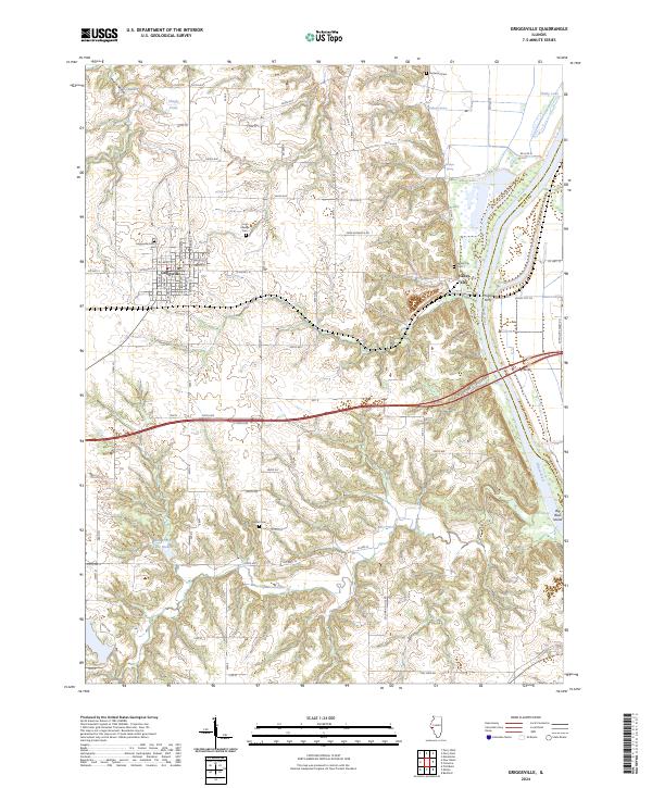
2024 Map of Griggsville
USGS Topo · Published 2024About this map
Griggsville occupies the high ground of the western Illinois prairie, where a grid of rural roads connects family homesteads and local landmarks. The landscape is defined by the sharp descent from these uplands into the eastern river bottoms, marked by deep drainages like Hatch Hollow, Church Hollow, and Napoleon Hollow. This topography creates a natural boundary between the agricultural plateau and the navigable waters of the Illinois River, which forms the eastern edge of the survey.
Find a feature on this map
82 named features on this map. Tap any name to fly to it.
Don’t see what you’re looking for? This feature index may not catch every label — zoom into the map to look around manually.
Map Details
Editions of this 2024 Griggsville Map
This is the sole edition of this map. No revisions or reprints were ever made.
Other maps of this area

1924 · Griggsville
USGS Topo · 1:62,500

1926 · Griggsville
USGS Topo · 1:62,500

1926 · Pittsfield
USGS Topo · 1:62,500

1926 · Mt Sterling
USGS Topo · 1:62,500

1928 · Meredosia
USGS Topo · 1:62,500

1929 · Mt Sterling
USGS Topo · 1:62,500

1931 · Meredosia
USGS Topo · 1:62,500

1948 · Quincy
USGS Topo · 1:250,000

1956 · Quincy
USGS Topo · 1:250,000
1975 · Meredosia SE
USGS Topo · 1:24,000