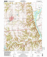
1998 Map of Griggsville
USGS Topo · Published 2001About this map
The town of Griggsville occupies the high ground between the Illinois River to the east and Lake Pittsfield to the southwest. This late-twentieth-century landscape is defined by the sharp transition from the flat agricultural uplands to the dissected bluffs of the river valley. Local history is anchored by the Fairground on the western edge of town and the Holy Family Ch near the center.
Find a feature on this map
33 named features on this map. Tap any name to fly to it.
Don’t see what you’re looking for? This feature index may not catch every label — zoom into the map to look around manually.
Map Details
Editions of this 1998 Griggsville Map
This is the sole edition of this map. No revisions or reprints were ever made.
Other maps of this area

1924 · Griggsville
USGS Topo · 1:62,500

1926 · Griggsville
USGS Topo · 1:62,500

1926 · Pittsfield
USGS Topo · 1:62,500

1926 · Mt Sterling
USGS Topo · 1:62,500

1928 · Meredosia
USGS Topo · 1:62,500

1929 · Mt Sterling
USGS Topo · 1:62,500

1931 · Meredosia
USGS Topo · 1:62,500

1948 · Quincy
USGS Topo · 1:250,000

1956 · Quincy
USGS Topo · 1:250,000
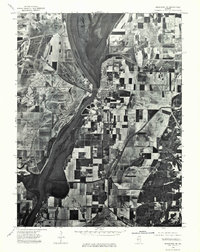
1975 · Meredosia SE
USGS Topo · 1:24,000