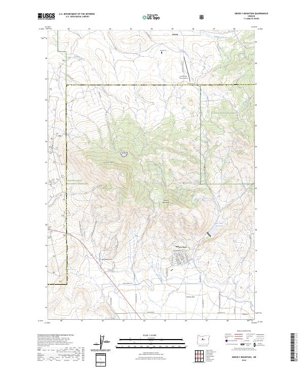
2024 Map of Grizzly Mountain
USGS Topo · Published 2024About this map
Grizzly Mtn dominates the central landscape of this quadrangle, serving as a high-elevation anchor between the Crooked River National Grassland to the west and the Ochoco National Forest to the east. The terrain transitions from the steep slopes of the Ochoco Mountains down toward the alluvial expanses of Grimes Flat in the south. This area reflects a long-standing ranching and rural residential character, with legacy infrastructure such as the Grizzly Cem near the small settlement of Grizzly and the privately situated Six Springs Ranch Airport.
Find a feature on this map
46 named features on this map. Tap any name to fly to it.
Don’t see what you’re looking for? This feature index may not catch every label — zoom into the map to look around manually.
Map Details
Editions of this 2024 Grizzly Mountain Map
This is the sole edition of this map. No revisions or reprints were ever made.
Other maps of this area

1926 · Bend
USGS Topo · 1:125,000

1928 · Madras
USGS Topo · 1:125,000

1929 · Bend
USGS Topo · 1:125,000

1931 · Madras
USGS Topo · 1:125,000

1955 · Bend
USGS Topo · 1:250,000

1957 · Bend
USGS Topo · 1:250,000

1958 · Bend
USGS Topo · 1:250,000

1962 · Oneil
USGS Topo · 1:24,000

1962 · Huston Lake
USGS Topo · 1:24,000

1962 · Prineville
USGS Topo · 1:24,000