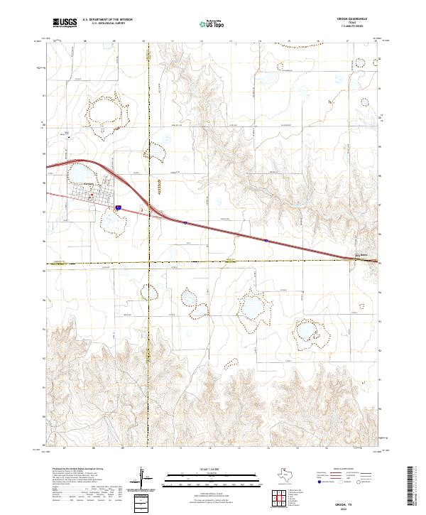
2022 Map of Groom
USGS Topo · Published 2022About this map
Groom sits at a crossroads of the High Plains, where the grid-work of the Texas Panhandle meets the rugged breaks of the Canadian River watershed. This survey showcases the town's street-level layout, including Front St and Shelton Ave, situated near the convergence of major ranch roads. The landscape is defined by the sharp transition from the flat agricultural plateau of Carson Co to the deeply incised drainages of McClellan Cr and Rawhide Cr as they flow toward the southeast.
Find a feature on this map
51 named features on this map. Tap any name to fly to it.
Don’t see what you’re looking for? This feature index may not catch every label — zoom into the map to look around manually.
Map Details
Editions of this 2022 Groom Map
This is the sole edition of this map. No revisions or reprints were ever made.
Other maps of this area

1954 · Amarillo
USGS Topo · 1:250,000

1958 · Amarillo
USGS Topo · 1:250,000

1960 · Groom
USGS Topo · 1:62,500

1962 · Roach Ranch
USGS Topo · 1:24,000

1964 · Jericho
USGS Topo · 1:24,000

1966 · Grandview School
USGS Topo · 1:24,000

1966 · White Deer SW
USGS Topo · 1:24,000
1968 · Deep Lake
USGS Topo · 1:24,000
1983 · Shamrock
USGS Topo · 1:100,000
1983 · Ashtola
USGS Topo · 1:24,000