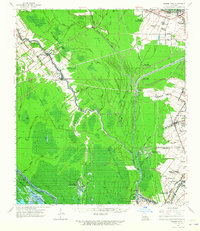
1962 Map of Grosse Tete
USGS Topo · Published 1965About this map
Myrtle Grove Plantation and Star Plantation stand as significant markers of the agricultural landscape along the river corridors of Iberville and West Baton Rouge Parishes. This 1962 revision by the Mississippi River Commission details a region defined by complex drainage and the intersection of industrial and rural life. The Intracoastal Waterway and the Texas and Pacific RR provide the primary transit backbone, connecting settlements like Grosse Tete and Addis.
Find a feature on this map
60 named features on this map. Tap any name to fly to it.
Don’t see what you’re looking for? This feature index may not catch every label — zoom into the map to look around manually.
Map Details
Editions of this 1962 Grosse Tete Map
2 editions found
Other maps of this area

1906 · Bayou Sara
USGS Topo · 1:125,000

1908 · Baton Rouge
USGS Topo · 1:62,500

1935 · Osca Bayou
USGS Topo · 1:62,500

1935 · Chicot Lake
USGS Topo · 1:62,500

1936 · White Castle
USGS Topo · 1:62,500

1939 · Zachary
USGS Topo · 1:62,500

1939 · Baton Rouge
USGS Topo · 1:62,500

1939 · Fordoche
USGS Topo · 1:62,500

1940 · Grosse Tete
USGS Topo · 1:62,500

1941 · Loreauville
USGS Topo · 1:62,500