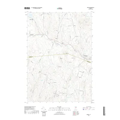
2018 Map of Groton
USGS Topo · Published 2018About this map
Wells River serves as the central corridor for this part of Vermont, carving through the hills to connect the village of Groton with South Ryegate. This landscape is defined by its deep local roots, visible in the numerous family and community burial grounds scattered across the terrain, including Groton Village Cem, Huckins-Caldwell Hill Cem, and the high-elevation Jefferson Hill Cem. The area around Ricker Pond and the settlement at Ricker Mills highlights the region's reliance on its waterways for early industry and community hubs. The rugged topography is punctuated by prominent peaks like Blue Mtn and Whitcher Mtn, while the boundary between Caledonia and Orange counties bisects the southern reaches of the map near the Pine Mountains.
Find a feature on this map
102 named features on this map. Tap any name to fly to it.
Don’t see what you’re looking for? This feature index may not catch every label — zoom into the map to look around manually.
Map Details
Editions of this 2018 Groton Map
This is the sole edition of this map. No revisions or reprints were ever made.
Other maps of this area

1931 · Woodsville
USGS Topo · 1:48,000

1935 · Woodsville
USGS Topo · 1:62,500

1938 · St. Johnsbury
USGS Topo · 1:48,000

1939 · Plainfield
USGS Topo · 1:48,000

1940 · Plainfield
USGS Topo · 1:62,500

1941 · Woodsville
USGS Topo · 1:62,500

1943 · Plainfield
USGS Topo · 1:62,500

1943 · St. Johnsbury
USGS Topo · 1:62,500

1947 · Corinth
USGS Topo · 1:62,500

1948 · East Barre
USGS Topo · 1:62,500