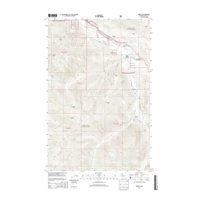
2014 Map of Grotto
USGS Topo · Published 2014About this map
Snoqualmie National Forest dominates this mountain landscape, where the settlement of Grotto sits at the northern edge along the Stevens Pass Hwy. This area serves as a critical transportation corridor through the Cascades, featuring the Tunnel on US 2 and the Cascade Stevens Highway Bridge crossing the South Fork Skykomish River. The map documents a network of high-altitude alpine lakes, including Crystal Lake, Coney Lake, and Bear Lakes, clustered around peaks like Palmer Mtn and Lennox Mtn. Recreation is a primary focus of the surveyed land, indicated by several established sites such as the Money Creek Campground and Miller River Campground. The drainage patterns are clearly defined by the W Fork Miller River and East Fork Miller River, which carve deep valleys through the rugged terrain of the t26n r11e township.
Find a feature on this map
48 named features on this map. Tap any name to fly to it.
Don’t see what you’re looking for? This feature index may not catch every label — zoom into the map to look around manually.
Map Details
Editions of this 2014 Grotto Map
This is the sole edition of this map. No revisions or reprints were ever made.
Other maps of this area

1902 · Skykomish
USGS Topo · 1:125,000

1905 · Skykomish
USGS Topo · 1:125,000

1921 · Sultan
USGS Topo · 1:125,000

1923 · Sultan
USGS Topo · 1:125,000

1957 · Index
USGS Topo · 1:62,500

1957 · Wenatchee
USGS Topo · 1:250,000

1960 · Mount Si
USGS Topo · 1:62,500

1965 · Evergreen Mtn
USGS Topo · 1:24,000

1965 · Grotto
USGS Topo · 1:24,000

1965 · Skykomish
USGS Topo · 1:24,000