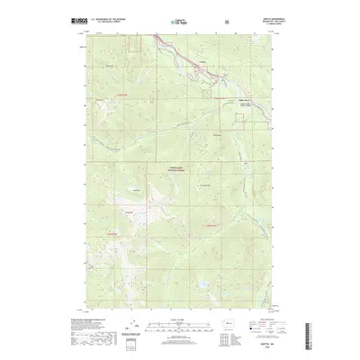
2020 Map of Grotto
USGS Topo · Published 2020About this map
Grotto and the small settlement of Miller River sit at the northern edge of this high-elevation landscape, where the South Fork Skykomish River carves a path alongside the Old Cascade Hwy. This territory is dominated by the steep peaks of the Snoqualmie National Forest, featuring prominent summits such as Palmer Mtn, Temple Mtn, and Cleveland Mtn. The map reveals a complex network of alpine hydrology, including Lake Kanim, Francis Lake, and Crystal Lake, which feed the various forks and creeks that drain toward the Skykomish and Snoqualmie basins. Transportation through this difficult terrain is marked by engineering feats like the Tunnel on US 2 and the Cascade Stevens Highway Bridge. Seasonal access is noted on routes such as Money Creek Road (Snow), indicating the high-country challenges of the Central Cascades.
Find a feature on this map
52 named features on this map. Tap any name to fly to it.
Don’t see what you’re looking for? This feature index may not catch every label — zoom into the map to look around manually.
Map Details
Editions of this 2020 Grotto Map
This is the sole edition of this map. No revisions or reprints were ever made.
Other maps of this area

1902 · Skykomish
USGS Topo · 1:125,000

1905 · Skykomish
USGS Topo · 1:125,000

1921 · Sultan
USGS Topo · 1:125,000

1923 · Sultan
USGS Topo · 1:125,000

1957 · Index
USGS Topo · 1:62,500

1957 · Wenatchee
USGS Topo · 1:250,000

1960 · Mount Si
USGS Topo · 1:62,500

1965 · Evergreen Mtn
USGS Topo · 1:24,000

1965 · Grotto
USGS Topo · 1:24,000

1965 · Skykomish
USGS Topo · 1:24,000