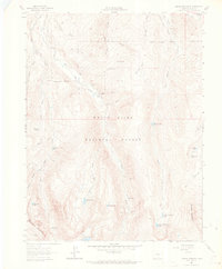
1962 Map of Grouse Mountain
USGS Topo · Published 1969About this map
White River National Forest defines this high-elevation landscape south of the Eagle River valley, as it appeared in the early 1960s. The map captures a topography shaped by steep drainage basins and glacial lakes, including Upper Turquoise Lake and Lower Turquoise Lake nestled below the ridge of Grouse Mountain. Evidence of early alpine resource extraction is visible through labels like the Ohio Tunnel and a solitary Mine near Baryeta Cabins, indicating a legacy of prospecting and seasonal habitation in these remote gulches.
Find a feature on this map
46 named features on this map. Tap any name to fly to it.
Don’t see what you’re looking for? This feature index may not catch every label — zoom into the map to look around manually.
Map Details
Editions of this 1962 Grouse Mountain Map
5 editions found

Other maps of this area

1889 · Leadville
USGS Topo · 1:125,000

1891 · Leadville
USGS Topo · 1:125,000

1909 · Mount Jackson
USGS Topo · 1:125,000

1911 · Mount Jackson
USGS Topo · 1:125,000

1934 · Minturn
USGS Topo · 1:62,500

1942 · Leadville
USGS Topo · 1:125,000

1949 · Holy Cross
USGS Topo · 1:62,500

1950 · Minturn
USGS Topo · 1:62,500

1951 · Holy Cross
USGS Topo · 1:62,500

1957 · Leadville
USGS Topo · 1:250,000