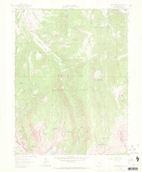
1962 Map of Grouse Mountain
USGS Topo · Published 1969About this map
The White River National Forest defines this high-elevation landscape, where the peaks of New York Mountain and Grouse Mountain overlook a complex network of alpine lakes and glacial drainages. In the early 1960s, the area remained largely defined by its extraction and water-management history. Mining efforts are evidenced by the Ohio Tunnel and Discovery Tunnel situated near Ohio Creek, while water diversion infrastructure like the Fleck Ditch and Johnson and Townsend Ditch trace the contours of the northern slopes. Settlement is sparse, with only the Baryeta Cabins appearing as a named structure in the backcountry.
Find a feature on this map
44 named features on this map. Tap any name to fly to it.
Don’t see what you’re looking for? This feature index may not catch every label — zoom into the map to look around manually.
Map Details
Editions of this 1962 Grouse Mountain Map
5 editions found

Other maps of this area

1889 · Leadville
USGS Topo · 1:125,000

1891 · Leadville
USGS Topo · 1:125,000

1909 · Mount Jackson
USGS Topo · 1:125,000

1911 · Mount Jackson
USGS Topo · 1:125,000

1934 · Minturn
USGS Topo · 1:62,500

1942 · Leadville
USGS Topo · 1:125,000

1949 · Holy Cross
USGS Topo · 1:62,500

1950 · Minturn
USGS Topo · 1:62,500

1951 · Holy Cross
USGS Topo · 1:62,500

1957 · Leadville
USGS Topo · 1:250,000