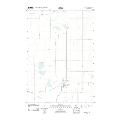
2010 Map of Grove City
USGS Topo · Published 2010About this map
Grove City serves as the central hub of this Meeker County landscape, where the local economy and community life are organized around a grid of agricultural section lines. This survey captures the town's layout including the Grove City Post Office and the Grove City Park Campground, reflecting its role as a regional waypoint. The surrounding prairie is defined by its hydrology, with Lund Lake and Helga Lake punctuating the fields, while the Middle Fork Crow River and Grove Creek drain the northern and eastern reaches. A cluster of burial sites, including the New Immanuel Lutheran Cemetery and First Lutheran Cemetery, provides significant data for genealogists tracking the area's heritage. The presence of the Grove Creek Raceway northwest of the town center adds a distinctive recreational landmark to the typical farming landscape.
Find a feature on this map
35 named features on this map. Tap any name to fly to it.
Don’t see what you’re looking for? This feature index may not catch every label — zoom into the map to look around manually.
Map Details
Editions of this 2010 Grove City Map
This is the sole edition of this map. No revisions or reprints were ever made.
Other maps of this area

1953 · Saint Cloud
USGS Topo · 1:250,000

1956 · Atwater
USGS Topo · 1:62,500

1957 · Saint Cloud
USGS Topo · 1:250,000

1958 · Saint Cloud
USGS Topo · 1:250,000

1967 · Grove City
USGS Topo · 1:24,000

1967 · Litchfield South
USGS Topo · 1:24,000

1967 · Litchfield North
USGS Topo · 1:24,000

1967 · Lake Koronis
USGS Topo · 1:24,000
1967 · Rosendale
USGS Topo · 1:24,000

1967 · Hawick
USGS Topo · 1:24,000
Featured Places
- Grove City, MN
- Four Jays Mobile Home Park, Grove City
- North Side Mobile Home Park, Grove City
- Crow River, MN
- Four Jays Mobile Home Park, Grove City