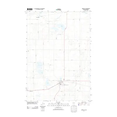
2013 Map of Grove City
USGS Topo · Published 2013About this map
Grove City serves as the primary hub of this Meeker County landscape, situated where Us-12 and MN-4 intersect. The surrounding prairie is characterized by a dense network of glacial lakes and wetlands, including Grove Lake, Lund Lake, and Wilcox Lake, which dominate the central terrain. Agricultural and community heritage is evident in the numerous named cemeteries such as Burr Oak Cem and Bethlehem Cem, while the Middle Fork Crow River meanders across the northern section near the settlement of Crow River. The presence of specialized sites like the Grove Creek Raceway and Grove City Park Campground suggests a region that balances its deep farming roots with local recreation. Precise road grids, from 560th Ave to 343rd St, provide clear context for tracing property lines and family holdings.
Find a feature on this map
42 named features on this map. Tap any name to fly to it.
Don’t see what you’re looking for? This feature index may not catch every label — zoom into the map to look around manually.
Map Details
Editions of this 2013 Grove City Map
This is the sole edition of this map. No revisions or reprints were ever made.
Other maps of this area

1953 · Saint Cloud
USGS Topo · 1:250,000

1956 · Atwater
USGS Topo · 1:62,500

1957 · Saint Cloud
USGS Topo · 1:250,000

1958 · Saint Cloud
USGS Topo · 1:250,000

1967 · Grove City
USGS Topo · 1:24,000

1967 · Litchfield South
USGS Topo · 1:24,000

1967 · Litchfield North
USGS Topo · 1:24,000

1967 · Lake Koronis
USGS Topo · 1:24,000
1967 · Rosendale
USGS Topo · 1:24,000

1967 · Hawick
USGS Topo · 1:24,000
Featured Places
- Grove City, MN
- Four Jays Mobile Home Park, Grove City
- North Side Mobile Home Park, Grove City
- Crow River, MN
- Four Jays Mobile Home Park, Grove City