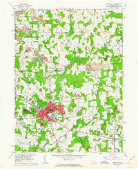
1961 Map of Grove City
USGS Topo · Published 1963About this map
Grove City serves as the central hub of this 1961 survey, where the campus of Grove City College and the industrial activity of the Bessemer and Lake Erie railroad define the local character. The landscape outside the borough is a mix of agricultural land, woodlots, and extensive extractive industry, evidenced by numerous strip mine sites concentrated in the northwest and east. These operations sit alongside long-established community institutions like the Cranberry School and Ebenezer Church.
Find a feature on this map
67 named features on this map. Tap any name to fly to it.
Don’t see what you’re looking for? This feature index may not catch every label — zoom into the map to look around manually.
Map Details
Editions of this 1961 Grove City Map
4 editions found
Other maps of this area

1909 · Franklin
USGS Topo · 1:62,500

1910 · Hilliards
USGS Topo · 1:62,500

1911 · Franklin
USGS Topo · 1:62,500

1911 · Stoneboro
USGS Topo · 1:62,500

1912 · Hilliards
USGS Topo · 1:62,500

1913 · Stoneboro
USGS Topo · 1:62,500

1913 · Mercer
USGS Topo · 1:62,500

1939 · Mercer
USGS Topo · 1:62,500

1943 · Mercer
USGS Topo · 1:62,500

1943 · Stoneboro
USGS Topo · 1:62,500