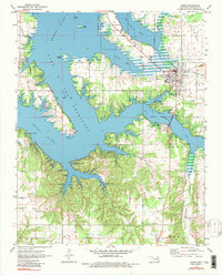
1971 Map of Grove
USGS Topo · Published 1984About this map
Grove serves as the primary hub on this northeastern Oklahoma survey, situated at the eastern edge of the expansive Lake O' the Cherokees. The landscape is defined by the winding inundation of the Neosho River, which creates complex peninsulas like Monkey Island and numerous inlets such as Carey Bay and Honey Creek. Aviation and tourism infrastructure appear well-established by the early 1970s, evidenced by the Monkey Island Airport, Shangri-La Airport, and a Seaplane Base tucked into Isles End Cove.
Find a feature on this map
45 named features on this map. Tap any name to fly to it.
Don’t see what you’re looking for? This feature index may not catch every label — zoom into the map to look around manually.
Map Details
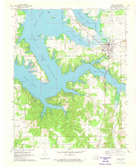
Editions of this 1971 Grove Map
2 editions found
Other maps of this area

1899 · Siloam Springs
USGS Topo · 1:125,000

1903 · Siloam Springs
USGS Topo · 1:125,000

1904 · Siloam Springs
USGS Topo · 1:125,000

1907 · Wyandotte
USGS Topo · 1:125,000

1909 · Wyandotte
USGS Topo · 1:125,000

1954 · Tulsa
USGS Topo · 1:250,000

1958 · Tulsa
USGS Topo · 1:250,000

1963 · Tulsa
USGS Topo · 1:250,000
1964 · Cayuga
USGS Topo · 1:24,000

1964 · Dodge
USGS Topo · 1:24,000