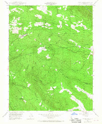
1947 Map of Groveland
USGS Topo · Published 1967About this map
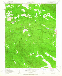
Groveland and the adjacent settlement of Second Garrotte anchor this 1947 field-checked study of the Sierra Nevada foothills. The map reveals a landscape defined by gold rush history and massive water infrastructure projects. The Hetch Hetchy Aqueduct cuts through the northern sections, tunneling beneath the steep ridges of the Stanislaus National Forest. Notable landmarks include the Bret Harte Cabin, a site tied to California’s literary past, and several resource-extraction points like the Kanaka Mine and Red Jacket Mine.
Find a feature on this map
37 named features on this map. Tap any name to fly to it.
Don’t see what you’re looking for? This feature index may not catch every label — zoom into the map to look around manually.
Map Details
Editions of this 1947 Groveland Map
4 editions found

Other maps of this area

1893 · Sonora
USGS Topo · 1:125,000

1896 · Sonora
USGS Topo · 1:125,000

1897 · Sonora
USGS Topo · 1:125,000

1898 · Sonora
USGS Topo · 1:125,000

1944 · Merced Falls
USGS Topo · 1:62,500

1947 · San Jose
USGS Topo · 1:250,000

1947 · Coulterville
USGS Topo · 1:62,500
1947 · Jawbone Ridge
USGS Topo · 1:24,000
1947 · Buckhorn Peak
USGS Topo · 1:24,000
1947 · Groveland
USGS Topo · 1:24,000