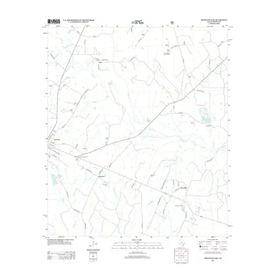
2013 Map of Groveton East
USGS Topo · Published 2013About this map
Groveton serves as the focal point for this survey of eastern Trinity County, where the Piney Woods landscape is defined by its winding creeks and scattered rural settlements. The area shows a transition from the town grid to established rural communities like Josserand and Woodlake. Genealogy and local history are anchored by several community burial grounds, including Lacy Cem, Sumpter Cem, and Josserand Cem. The industrial and fire-management history of the region is evident in landmarks such as the Piney Woods Lookout Tower and the presence of Old Railroad St, hinting at the timber and rail infrastructure that once shaped these woods.
Find a feature on this map
64 named features on this map. Tap any name to fly to it.
Don’t see what you’re looking for? This feature index may not catch every label — zoom into the map to look around manually.
Map Details
Editions of this 2013 Groveton East Map
This is the sole edition of this map. No revisions or reprints were ever made.
Other maps of this area

1953 · Palestine
USGS Topo · 1:250,000

1954 · Beaumont
USGS Topo · 1:250,000

1955 · New Willard
USGS Topo · 1:62,500

1957 · Beaumont
USGS Topo · 1:250,000

1957 · Palestine
USGS Topo · 1:250,000

1960 · Colita
USGS Topo · 1:24,000

1963 · Crecy
USGS Topo · 1:24,000

1963 · Groveton West
USGS Topo · 1:24,000
1963 · Pennington
USGS Topo · 1:24,000

1963 · Groveton East
USGS Topo · 1:24,000