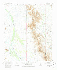
1964 Map of Growler Peak
USGS Topo · Published 1982About this map
Growler Mountains dominate the central landscape of this Pima County survey, creating a formidable barrier between the expansive Growler Valley to the west and the intricate drainage of Daniels Arroyo to the east. This arid environment is defined by its strategic water points and military use, as the terrain falls within the Luke Air Force Range and the Cabeza Prieta Game Range. Human activity is marked by isolated outposts such as Charlie Bell Wells and Salt Well, which served as critical resources in a region otherwise characterized by Jeep trails and rugged peaks like Sheep Peak and Growler Peak. The map illustrates the specialized infrastructure of the mid-20th century desert, including a Landing Strip near the Military Reservation Boundary, facilitating access to this remote interior for defense and wildlife management purposes.
Find a feature on this map
28 named features on this map. Tap any name to fly to it.
Don’t see what you’re looking for? This feature index may not catch every label — zoom into the map to look around manually.
Map Details
Editions of this 1964 Growler Peak Map
3 editions found

Other maps of this area

1927 · Aguila Mountains
USGS Topo · 1:48,000

1930 · Aguila Mountains
USGS Topo · 1:62,500

1932 · Ajo
USGS Topo · 1:62,500

1934 · Ajo
USGS Topo · 1:62,500

1953 · Ajo
USGS Topo · 1:250,000

1957 · Ajo
USGS Topo · 1:250,000

1958 · Ajo
USGS Topo · 1:250,000

1958 · Midway
USGS Topo · 1:62,500

1962 · Ajo
USGS Topo · 1:250,000

1963 · Ajo
USGS Topo · 1:250,000