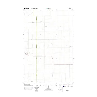
2013 Map of Grygla
USGS Topo · Published 2013About this map
Grygla serves as the primary hub in this corner of Northwest Minnesota, where the Mud River winds through the landscape. The settlement is centered around the intersection of Woodrow St and MN-89, reflecting a rural town plan defined by a rigid grid of agricultural roads. This 2013 survey illustrates the sparse but steady development along the Marshall Co and Beltrami Co line, where family-named routes such as Braseth Rd NW and Dyrseth Rd NW segment the territory. Genealogy researchers will find several notable burial sites including Saint Olaf Cem, Valley Cem, and Bethesda Cem, which are scattered among the section lines and offer a record of the community’s early foundations.
Find a feature on this map
24 named features on this map. Tap any name to fly to it.
Don’t see what you’re looking for? This feature index may not catch every label — zoom into the map to look around manually.
Map Details
Editions of this 2013 Grygla Map
This is the sole edition of this map. No revisions or reprints were ever made.
Other maps of this area
1918 · Malcolm
USGS Topo · 1:62,500
1918 · Jelle
USGS Topo · 1:62,500
1919 · Liner
USGS Topo · 1:62,500
1954 · Roseau
USGS Topo · 1:250,000
1957 · Roseau
USGS Topo · 1:250,000
1958 · Roseau
USGS Topo · 1:250,000
1973 · Grygla
USGS Topo · 1:24,000
1973 · Grygla SW
USGS Topo · 1:24,000
1973 · Erie NE
USGS Topo · 1:24,000
1973 · Randeen Ridge
USGS Topo · 1:24,000