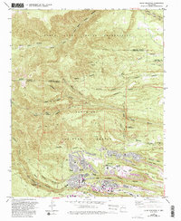
1984 Map of Guaje Mountain
USGS Topo · Published 1993About this map
The Santa Clara Indian Reservation and Santa Fe National Forest dominate this landscape, where the residential expansion of Los Alamos meets complex canyon and mesa topography. Development is concentrated in the southern portion, characterized by the residential clusters of the Mobile Home Park and institutional sites like the Univ of N Mex (Los Alamos). The map details the educational infrastructure of the era, including Pueblo Jr High Sch and Barranca Mesa Sch.
Find a feature on this map
59 named features on this map. Tap any name to fly to it.
Don’t see what you’re looking for? This feature index may not catch every label — zoom into the map to look around manually.
Map Details
Editions of this 1984 Guaje Mountain Map
Other maps of this area

1892 · Santa Clara
USGS Topo · 1:125,000

1918 · Abiquiu
USGS Topo · 1:125,000

1952 · White Rock
USGS Topo · 1:24,000

1952 · Valle Toledo
USGS Topo · 1:24,000

1952 · Frijoles
USGS Topo · 1:24,000

1952 · Puye
USGS Topo · 1:24,000

1952 · Guaje Mountain
USGS Topo · 1:24,000

1953 · Chili
USGS Topo · 1:24,000

1953 · Vallecitos
USGS Topo · 1:24,000

1953 · Polvadera Peak
USGS Topo · 1:24,000