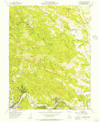
1955 Map of Guerneville
USGS Topo · Published 1956About this map
The Russian River carves a winding path through the heart of this Sonoma County landscape, anchoring a string of mid-century resort communities and industrial outposts. From the established town of Guerneville, the river leads past Rio Nido, Korbel, and Hilton, reflecting an era when these riverfront settlements were primary destinations for recreation and timber. The presence of the Sonoma Mine near Mt Jackson and various scattered Sawmill sites indicates the region's historical reliance on resource extraction, while the transition of several local institutions is marked by Daniels School (Aband) and Lafayette Sch (Aband).
Find a feature on this map
64 named features on this map. Tap any name to fly to it.
Don’t see what you’re looking for? This feature index may not catch every label — zoom into the map to look around manually.
Map Details
Editions of this 1955 Guerneville Map
4 editions found
Other maps of this area

1920 · Healdsburg
USGS Topo · 1:62,500

1921 · Skaggs
USGS Topo · 1:62,500

1933 · Healdsburg
USGS Topo · 1:48,000

1935 · Sebastopol
USGS Topo · 1:48,000

1940 · Healdsburg
USGS Topo · 1:62,500

1942 · Sebastopol
USGS Topo · 1:62,500

1943 · Cazadero
USGS Topo · 1:24,000

1943 · Duncans Mills
USGS Topo · 1:24,000

1943 · Skaggs Springs
USGS Topo · 1:24,000

1944 · Skaggs Springs
USGS Topo · 1:31,680