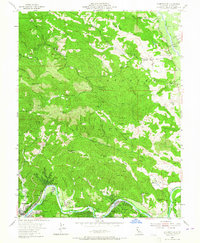
1955 Map of Guerneville
USGS Topo · Published 1965About this map
Guerneville serves as the hub for this mid-century survey of the Russian River corridor, where seasonal recreation and industrial history meet among the redwoods. The southern portion of the map traces the winding Russian River through a series of riverside communities including Rio Nido, Hilton, and Hacienda. These settlements, often centered around vacation and resort culture like Odd Fellows Park, are hemmed in by the significant elevations of Mt Jackson and Black Mtn.
Find a feature on this map
62 named features on this map. Tap any name to fly to it.
Don’t see what you’re looking for? This feature index may not catch every label — zoom into the map to look around manually.
Map Details
Editions of this 1955 Guerneville Map
4 editions found
Other maps of this area

1920 · Healdsburg
USGS Topo · 1:62,500

1921 · Skaggs
USGS Topo · 1:62,500

1933 · Healdsburg
USGS Topo · 1:48,000

1935 · Sebastopol
USGS Topo · 1:48,000

1940 · Healdsburg
USGS Topo · 1:62,500

1942 · Sebastopol
USGS Topo · 1:62,500

1943 · Cazadero
USGS Topo · 1:24,000

1943 · Duncans Mills
USGS Topo · 1:24,000

1943 · Skaggs Springs
USGS Topo · 1:24,000

1944 · Skaggs Springs
USGS Topo · 1:31,680