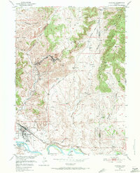
1950 Map of Guernsey
USGS Topo · Published 1971About this map
The North Platte River carves through the southern landscape of this 1950s Wyoming survey, where industrial and military footprints meet the deep history of westward expansion. At the river's bend, the town of Guernsey serves as a hub, neighbored by the Camp Guernsey State Military Reservation and a local Cem. Evidence of the region’s mineral wealth is scattered across the Haystack Range, with complex mining operations appearing at Sunrise and Hartville, including Chicago Mine Hill and several quarries. Transportation history is remarkably preserved here, with the Oregon Trail and the distinct Oregon Trail Ruts cutting across the terrain alongside the modern Chicago Burlington and Quincy railroad. The map further documents the rural homesteading patterns of the era through isolated landmarks like Frederick Ranch, Ross Ranch, and Graves Ranch.
Find a feature on this map
48 named features on this map. Tap any name to fly to it.
Don’t see what you’re looking for? This feature index may not catch every label — zoom into the map to look around manually.
Map Details
Editions of this 1950 Guernsey Map
4 editions found
Other maps of this area

1896 · Hartville
USGS Topo · 1:125,000

1901 · Hartville
USGS Topo · 1:125,000

1950 · Guernsey
USGS Topo · 1:24,000

1950 · Casebier Hill
USGS Topo · 1:24,000

1950 · Fort Laramie
USGS Topo · 1:24,000

1950 · Register Cliff
USGS Topo · 1:24,000

1950 · Haushar Ranch
USGS Topo · 1:24,000

1950 · Hell Gap
USGS Topo · 1:24,000

1950 · Guernsey Reservoir
USGS Topo · 1:24,000

1951 · Haushar Ranch
USGS Topo · 1:24,000