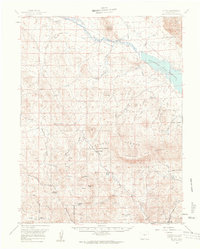
1959 Map of Guffey
USGS Topo · Published 1961About this map
Guffey stands as a focal point in this high-altitude landscape of central Colorado, situated at the southern end of a complex network of ranching units and mountain peaks. The northern reaches are defined by the winding South Platte River and the significant basin of the Elevenmile Canyon Reservoir, reflecting mid-century water management and land use within the Pike National Forest. An Old Railroad Grade traces a path through the northern valley, hinting at the area's former transportation corridors before the shift to improved and light-duty roads.
Find a feature on this map
36 named features on this map. Tap any name to fly to it.
Don’t see what you’re looking for? This feature index may not catch every label — zoom into the map to look around manually.
Map Details
Editions of this 1959 Guffey Map
3 editions found

Other maps of this area

1893 · Platte Canyon
USGS Topo · 1:125,000

1894 · Pikes Peak
USGS Topo · 1:125,000

1901 · Pikes Peak
USGS Topo · 1:125,000

1942 · Cover Mtn.
USGS Topo · 1:62,500

1948 · Cover Mtn.
USGS Topo · 1:62,500

1953 · Denver
USGS Topo · 1:250,000

1954 · Pueblo
USGS Topo · 1:250,000

1956 · Tarryall
USGS Topo · 1:24,000

1956 · Sulphur Mountain
USGS Topo · 1:24,000

1956 · Elevenmile Canyon
USGS Topo · 1:24,000