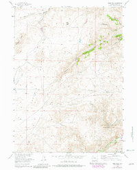
1955 Map of Guide Rock
USGS Topo · Published 1982About this map
The Laramie Mountains dominate this high-altitude landscape in Albany County, where complex drainage systems like West Bluegrass Creek and East Bluegrass Creek converge. The topography is defined by significant vertical relief, from the namesake Guide Rock formation to the deep cut of Halleck Canyon. The map captures a specialized land use in the southern portion with the Sybille Game and Fish Experimental Unit, established along the banks of North Sybille Creek. This area's transition from the windswept height of Bluegrass Ridge down to the creek valleys is marked by isolated structures such as a lone School, reflecting the sparse, resource-focused settlement pattern of Wyoming's interior during the mid-20th century.
Find a feature on this map
17 named features on this map. Tap any name to fly to it.
Don’t see what you’re looking for? This feature index may not catch every label — zoom into the map to look around manually.
Map Details
Editions of this 1955 Guide Rock Map
3 editions found
Other maps of this area

1954 · Cheyenne
USGS Topo · 1:250,000

1955 · Poe Mountain
USGS Topo · 1:24,000

1955 · Dodge Ranch
USGS Topo · 1:24,000

1955 · Bluegrass Wells
USGS Topo · 1:24,000

1955 · Sybille Springs
USGS Topo · 1:24,000

1955 · Moonshine Peak
USGS Topo · 1:24,000

1955 · Indian Guide
USGS Topo · 1:24,000

1955 · Guide Rock
USGS Topo · 1:24,000

1955 · Sheep Rock
USGS Topo · 1:24,000

1955 · Bull Camp Peak
USGS Topo · 1:24,000