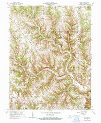
1966 Map of Guilford
USGS Topo · Published 1990About this map
Guilford sits at the confluence of several watercourses in central Dearborn County, where the West Fork and East Fork meet to form Tanners Creek. This 1966 revision shows a landscape defined by sharp elevation changes and high ridges, including the prominent Devil Backbone and Ester Ridge. The settlement pattern follows these high grounds, with small communities like New Alsace, Yorkville, and Dover established along the ridge tops to avoid the steep drainages of Sawdon Creek and Kline Creek.
Find a feature on this map
54 named features on this map. Tap any name to fly to it.
Don’t see what you’re looking for? This feature index may not catch every label — zoom into the map to look around manually.
Map Details
Editions of this 1966 Guilford Map
2 editions found
Other maps of this area

1915 · Lawrenceburg
USGS Topo · 1:48,000

1915 · Harrison
USGS Topo · 1:48,000

1928 · Lawrenceburg
USGS Topo · 1:62,500

1932 · Lawrenceburg
USGS Topo · 1:62,500

1943 · Aurora
USGS Topo · 1:24,000

1943 · Hooven
USGS Topo · 1:24,000

1943 · Guilford
USGS Topo · 1:24,000

1943 · Lawrenceburg
USGS Topo · 1:24,000

1953 · Aurora
USGS Topo · 1:24,000

1953 · Guilford
USGS Topo · 1:24,000