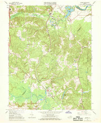
1966 Map of Guinea
USGS Topo · Published 1968About this map
The Jackson Shrine stands as a focal point of this mid-century landscape, marking the historic site where Stonewall Jackson died, situated near the hamlet of Guinea. The Richmond Fredericksburg and Potomac railroad corridor dictates the region's development, connecting small trackside communities like Summit, Massaponax, and Hamilton Crossing. To the east, the A P Hill Military Reservation and the Rappahannock River define the natural and tactical boundaries of the terrain.
Find a feature on this map
41 named features on this map. Tap any name to fly to it.
Don’t see what you’re looking for? This feature index may not catch every label — zoom into the map to look around manually.
Map Details
Editions of this 1966 Guinea Map
4 editions found
Other maps of this area

1887 · Spottsylvania
USGS Topo · 1:125,000

1889 · Fredericksburg
USGS Topo · 1:125,000

1892 · Fredericksburg
USGS Topo · 1:125,000

1892 · Spottsylvania
USGS Topo · 1:125,000

1894 · Fredericksburg
USGS Topo · 1:125,000

1926 · Stafford
USGS Topo · 1:62,500

1931 · Stafford
USGS Topo · 1:62,500

1942 · Bowling Green
USGS Topo · 1:31,680

1942 · Woodford
USGS Topo · 1:31,680

1942 · Guinea
USGS Topo · 1:31,680