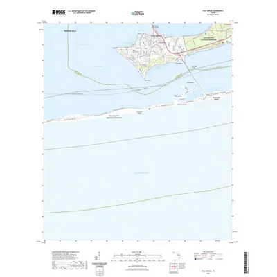
2021 Map of Gulf Breeze
USGS Topo · Published 2021About this map
Gulf Islands National Seashore dominates this coastal landscape, spanning the thin barrier of Santa Rosa Island and the adjacent mainland peninsula. This 2021 survey illustrates the modern residential development of Gulf Breeze, where a dense network of streets like Fairpoint Dr and Shoreline Dr reaches out toward Town Point and Deer Point. The map provides a look at the local geography where the Santa Rosa Sound meets Little Sabine Bay, highlighting the proximity of Villa Sabine and the developed waterfront of Pensacola Beach.
Find a feature on this map
79 named features on this map. Tap any name to fly to it.
Don’t see what you’re looking for? This feature index may not catch every label — zoom into the map to look around manually.
Map Details
Editions of this 2021 Gulf Breeze Map
This is the sole edition of this map. No revisions or reprints were ever made.
Other maps of this area

1921 · Pensacola
USGS Topo · 1:62,500

1921 · Fort Barrancas
USGS Topo · 1:62,500

1941 · Fort Barrancas
USGS Topo · 1:62,500

1941 · Pensacola
USGS Topo · 1:62,500

1942 · Pensacola
USGS Topo · 1:62,500

1943 · Fort Barrancas
USGS Topo · 1:62,500

1944 · West Pensacola
USGS Topo · 1:25,000
1944 · Oriole Beach
USGS Topo · 1:25,000

1944 · Gulf Breeze
USGS Topo · 1:25,000
1944 · Fort Barrancas
USGS Topo · 1:25,000