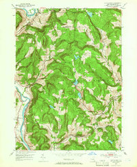
1952 Map of Gulf Summit
USGS Topo · Published 1966About this map
The Susquehanna River winds through the western edge of this Broome County landscape, carving a valley that dictated the placement of early settlements and transportation routes. In the early 1950s, the riverside communities of East Windsor, Damascus, and South Windsor remained central to local life, while the steep uplands to the east were defined by peaks like Alexander Hill. The map reveals a distinct division of the terrain, with the high ground populated by small upland ponds including Sky Lake, Deer Lake, and Fly Pond.
Find a feature on this map
31 named features on this map. Tap any name to fly to it.
Don’t see what you’re looking for? This feature index may not catch every label — zoom into the map to look around manually.
Map Details
Editions of this 1952 Gulf Summit Map
4 editions found
Other maps of this area

1905 · Nineveh
USGS Topo · 1:62,500

1924 · Starrucca
USGS Topo · 1:48,000

1924 · Deposit
USGS Topo · 1:62,500

1926 · Deposit
USGS Topo · 1:62,500

1926 · Starrucca
USGS Topo · 1:62,500

1930 · Starrucca
USGS Topo · 1:48,000

1932 · Susquehanna
USGS Topo · 1:62,500

1933 · Starrucca
USGS Topo · 1:62,500

1935 · Susquehanna
USGS Topo · 1:62,500

1943 · Honesdale
USGS Topo · 1:125,000