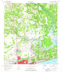
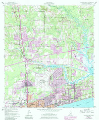
1954 Map of Gulfport North
USGS Topo · Published 1967About this map
Mississippi's Gulf Coast experienced significant mid-century development as Gulfport expanded north toward the De Soto National Forest. This survey captures the urban-rural interface along the Illinois Central railroad, which links established communities like Lyman and Nugent to the shoreline. The landscape is defined by the winding course of Bernard Bayou and the Biloxi River, where the historic settlement of Handsboro sits at a critical crossing.
Find a feature on this map
40 named features on this map. Tap any name to fly to it.
Don’t see what you’re looking for? This feature index may not catch every label — zoom into the map to look around manually.
Map Details
Editions of this 1954 Gulfport North Map
6 editions found
Other maps of this area

1953 · Mobile
USGS Topo · 1:250,000

1954 · Vestry
USGS Topo · 1:62,500

1954 · McHenry
USGS Topo · 1:62,500

1954 · Gulfport North
USGS Topo · 1:24,000

1954 · Gulfport South
USGS Topo · 1:24,000

1954 · Biloxi
USGS Topo · 1:24,000

1954 · Biloxi
USGS Topo · 1:62,500

1955 · Pass Christian
USGS Topo · 1:24,000

1956 · Gulfport NW
USGS Topo · 1:24,000

1957 · Mobile
USGS Topo · 1:250,000