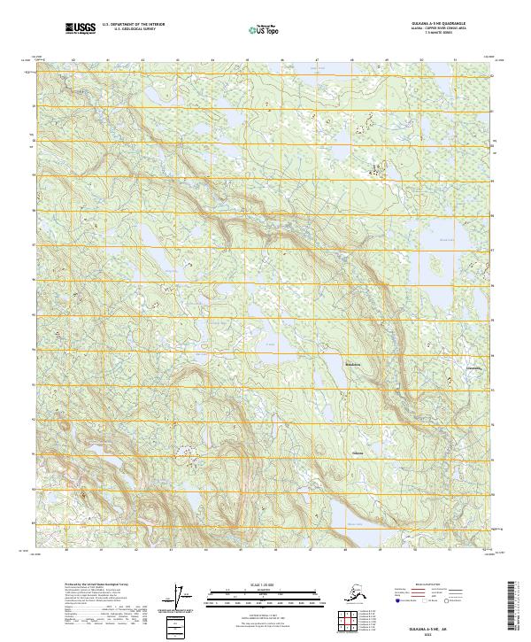
2023 Map of Gulkana A-5 NE
USGS Topo · Published 2023About this map
Glennallen and the nearby settlements of Mendeltna and Tolsona anchor this 2023 survey of the Copper River Census Area. The landscape is defined by a dense network of water bodies, including the elongated Long Lake, the central T Lake, and the smaller Caribou Lake and Rat Lake. The drainage system is dominated by the winding paths of Tolsona Creek and Hudson Creek, which cut through the varied terrain between Frenchman Lake and Island Lake.
Find a feature on this map
21 named features on this map. Tap any name to fly to it.
Don’t see what you’re looking for? This feature index may not catch every label — zoom into the map to look around manually.
Map Details
Editions of this 2023 Gulkana A-5 NE Map
This is the sole edition of this map. No revisions or reprints were ever made.
Other maps of this area

1949 · Gulkana A-5
USGS Topo · 1:63,360

1951 · Gulkana
USGS Topo · 1:250,000

1951 · Gulkana B-5
USGS Topo · 1:63,360

1951 · Gulkana A-4
USGS Topo · 1:63,360

1951 · Gulkana B-4
USGS Topo · 1:63,360

1952 · Gulkana A-5
USGS Topo · 1:63,360

1952 · Gulkana A-4
USGS Topo · 1:63,360
1952 · Gulkana B-4
USGS Topo · 1:63,360
1952 · Gulkana B-5
USGS Topo · 1:63,360

1959 · Gulkana
USGS Topo · 1:250,000