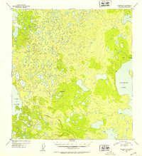
1952 Map of Gulkana B-5
USGS Topo · Published 1953About this map
Crosswind Lake and the eastern fringes of Lake Louise dominate this subarctic landscape in the early 1950s. The topography is defined by a dense concentration of smaller lakes and wetlands, indicative of the glacial terrain within the Gulkana region. Human presence is sparse, marked only by isolated Cabins and a lone Cabin near the lakeshores, likely serving as seasonal shelters for trapping or subsistence. The Whetstone benchmark stands as a primary survey point amidst the low-lying drainage of Tolsona Creek, which meanders through the southern portion of the quadrangle. This survey, compiled from 1950 aerial photography, captures the primitive state of the interior before any significant road development or modern settlement reached this specific corridor between the lakes.
Find a feature on this map
6 named features on this map. Tap any name to fly to it.
Don’t see what you’re looking for? This feature index may not catch every label — zoom into the map to look around manually.
Map Details
Editions of this 1952 Gulkana B-5 Map
2 editions found
Other maps of this area

1949 · Gulkana A-5
USGS Topo · 1:63,360

1949 · Gulkana A-6
USGS Topo · 1:63,360

1950 · Gulkana C-4
USGS Topo · 1:63,360

1950 · Gulkana B-6
USGS Topo · 1:63,360

1951 · Gulkana
USGS Topo · 1:250,000

1951 · Gulkana B-5
USGS Topo · 1:63,360

1951 · Gulkana A-4
USGS Topo · 1:63,360

1951 · Gulkana C-5
USGS Topo · 1:63,360

1951 · Gulkana B-4
USGS Topo · 1:63,360

1951 · Gulkana C-6
USGS Topo · 1:63,360