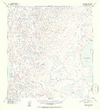
1952 Map of Gulkana B-5
USGS Topo · Published 1953About this map
Crosswind Lake and the eastern edge of Lake Louise dominate this subarctic landscape in the early 1950s. The terrain is a dense network of countless unnamed kettle ponds and wetlands, characteristic of the glaciated Copper River Basin. While the map shows a mostly untouched wilderness, small signs of human presence appear in the form of isolated Cabin and Cabins structures located along the lake shores and near the headwaters of Tolsona Creek. These labels suggest seasonal hunting, trapping, or early recreational outposts established before more extensive regional development. Surveyors established the Whetstone VABM 2643 benchmark as a primary triangulation point to map this complex, water-heavy topography during the post-war efforts to document the Alaskan interior.
Find a feature on this map
6 named features on this map. Tap any name to fly to it.
Don’t see what you’re looking for? This feature index may not catch every label — zoom into the map to look around manually.
Map Details
Editions of this 1952 Gulkana B-5 Map
2 editions found
Other maps of this area

1949 · Gulkana A-5
USGS Topo · 1:63,360

1949 · Gulkana A-6
USGS Topo · 1:63,360

1950 · Gulkana C-4
USGS Topo · 1:63,360

1950 · Gulkana B-6
USGS Topo · 1:63,360

1951 · Gulkana
USGS Topo · 1:250,000

1951 · Gulkana B-5
USGS Topo · 1:63,360

1951 · Gulkana A-4
USGS Topo · 1:63,360

1951 · Gulkana C-5
USGS Topo · 1:63,360

1951 · Gulkana B-4
USGS Topo · 1:63,360

1951 · Gulkana C-6
USGS Topo · 1:63,360