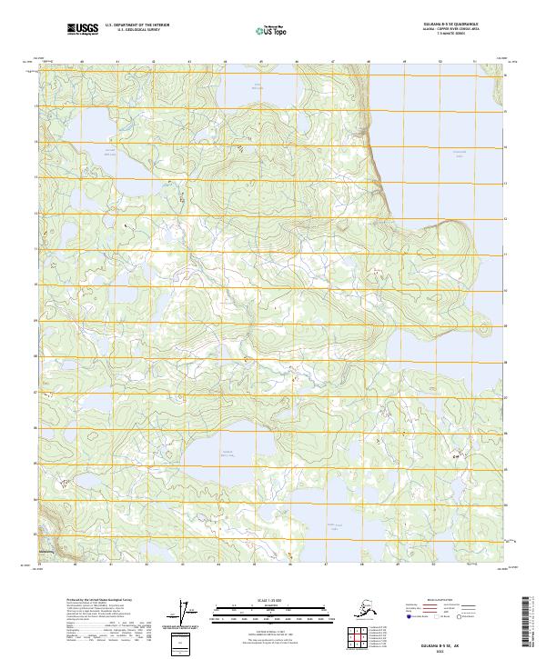
2023 Map of Gulkana B-5 SE
USGS Topo · Published 2023About this map
Mendeltna lies at the southwestern edge of this Alaska Copper River Census Area terrain, where the landscape is defined by a complex network of glacial lakes and wetlands. The hydrography of the region is punctuated by prominent water bodies like Crosswind Lake in the northeast and Salmon Berry Lake in the south-central portion of the quadrangle. These lakes, including First Hill Lake and Second Hill Lake, suggest a basin typical of the interior plateau, where drainage is managed by small waterways such as Tolsona Creek. The map reflects a modern inventory of the area's natural features, highlighting the isolation and watery character of the land between the major river valleys of the Gulkana region. While human infrastructure is sparse, the named landmarks like Game Trail Lake point toward the area's significance for local subsistence and seasonal movement.
Find a feature on this map
14 named features on this map. Tap any name to fly to it.
Don’t see what you’re looking for? This feature index may not catch every label — zoom into the map to look around manually.
Map Details
Editions of this 2023 Gulkana B-5 SE Map
This is the sole edition of this map. No revisions or reprints were ever made.
Other maps of this area

1949 · Gulkana A-5
USGS Topo · 1:63,360

1951 · Gulkana
USGS Topo · 1:250,000

1951 · Gulkana B-5
USGS Topo · 1:63,360

1951 · Gulkana A-4
USGS Topo · 1:63,360

1951 · Gulkana B-4
USGS Topo · 1:63,360

1952 · Gulkana A-5
USGS Topo · 1:63,360

1952 · Gulkana A-4
USGS Topo · 1:63,360
1952 · Gulkana B-4
USGS Topo · 1:63,360
1952 · Gulkana B-5
USGS Topo · 1:63,360

1959 · Gulkana
USGS Topo · 1:250,000