
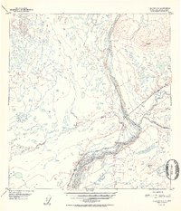
1952 Map of Gulkana C-2
USGS Topo · Published 1952About this map
Chistochina River and Copper River converge in this mid-century survey, defining a landscape at the junction of glacial waterways and early interior infrastructure. The area is anchored by the Sinona Lodge and the nearby Chistochina Airstrip, which served as vital access points for travelers and residents in the Alaska interior during the post-war years. The terrain is marked by numerous benchmark elevations and distinctive peaks like Indian, reflecting the intensive geodetic work performed by the U.S. Geological Survey and USC&GS to map the Territory of Alaska.
Find a feature on this map
21 named features on this map. Tap any name to fly to it.
Don’t see what you’re looking for? This feature index may not catch every label — zoom into the map to look around manually.
Map Details
Editions of this 1952 Gulkana C-2 Map
2 editions found
Other maps of this area

1949 · Gulkana C-2
USGS Topo · 1:63,360

1949 · Gulkana D-3
USGS Topo · 1:63,360

1949 · Gulkana B-2
USGS Topo · 1:63,360

1949 · Gulkana C-1
USGS Topo · 1:63,360

1950 · Gulkana B-3
USGS Topo · 1:63,360

1950 · Gulkana C-3
USGS Topo · 1:63,360

1951 · Gulkana
USGS Topo · 1:250,000

1952 · Gulkana D-3
USGS Topo · 1:63,360

1952 · Gulkana B-3
USGS Topo · 1:63,360

1952 · Gulkana B-2
USGS Topo · 1:63,360