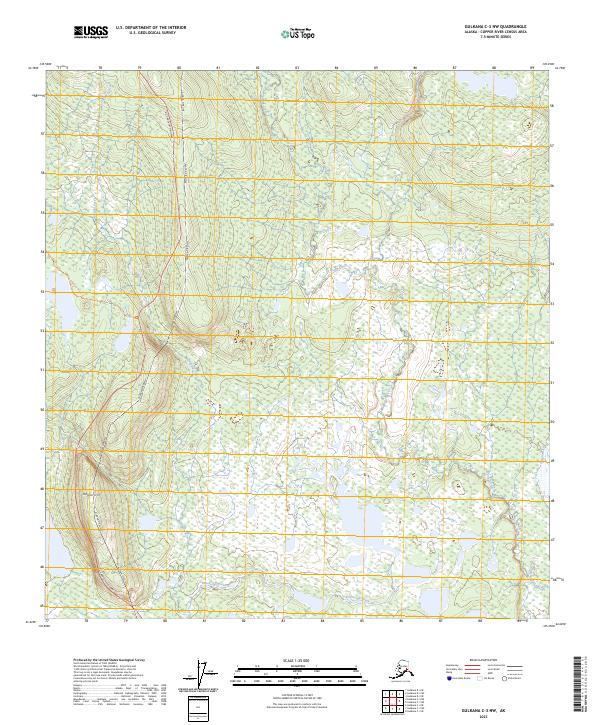
2023 Map of Gulkana C-3 NW
USGS Topo · Published 2023About this map
The Alaska Pipeline corridors and industrial infrastructure define this modern view of the Copper River Census Area. Running parallel to the historic Richardson Highway, the pipeline route cuts a distinct north-south path through a complex aquatic landscape of wetlands and winding waterways. The southeastern corner is marked by the wide reach of the Gakona River, while the western portion of the map is shaped by the drainage systems of Haggard Creek and Spring Creek. Rising above the surrounding lowlands, Hogan Hill provides a primary topographic landmark in an area otherwise dominated by the meandering path of Sourdough Creek. This survey captures the essential intersection of Alaska's critical energy transport corridor and its preserved wilderness interior.
Find a feature on this map
11 named features on this map. Tap any name to fly to it.
Don’t see what you’re looking for? This feature index may not catch every label — zoom into the map to look around manually.
Map Details
Editions of this 2023 Gulkana C-3 NW Map
This is the sole edition of this map. No revisions or reprints were ever made.
Other maps of this area

1949 · Gulkana D-3
USGS Topo · 1:63,360

1950 · Gulkana D-4
USGS Topo · 1:63,360

1950 · Gulkana C-3
USGS Topo · 1:63,360

1950 · Gulkana C-4
USGS Topo · 1:63,360

1951 · Gulkana
USGS Topo · 1:250,000

1952 · Gulkana D-3
USGS Topo · 1:63,360

1952 · Gulkana D-4
USGS Topo · 1:63,360
1952 · Gulkana C-3
USGS Topo · 1:63,360
1952 · Gulkana C-4
USGS Topo · 1:63,360
1954 · Gulkana D-3
USGS Topo · 1:63,360