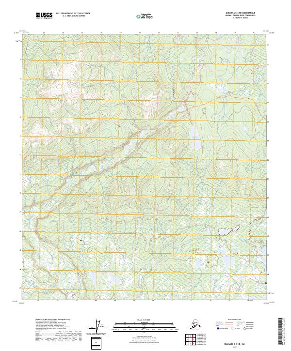
2023 Map of Gulkana C-4 NE
USGS Topo · Published 2023About this map
The Gulkana Wild and Scenic River dominates this interior Alaska landscape, carving a prominent corridor through the Copper River Census Area. The river's path is marked by significant topographical shifts, particularly as it flows through the vicinity of Canyon Lake. This 2023 survey highlights a primitive transportation network consisting of several overland routes, including the Gulkana River Portage Trl and the Haggard Creek Trl. These trails suggest a landscape where movement is dictated by the river's bends and the surrounding elevation changes. The presence of the Haggard Creek Spur Trl further indicates established points of access for those navigating the backcountry. Unlike more developed regions, the lack of permanent settlements or structures emphasizes the protected and wilderness character of this federally recognized waterway and its immediate environment.
Find a feature on this map
11 named features on this map. Tap any name to fly to it.
Don’t see what you’re looking for? This feature index may not catch every label — zoom into the map to look around manually.
Map Details
Editions of this 2023 Gulkana C-4 NE Map
This is the sole edition of this map. No revisions or reprints were ever made.
Other maps of this area

1949 · Gulkana D-3
USGS Topo · 1:63,360

1950 · Gulkana D-4
USGS Topo · 1:63,360

1950 · Gulkana C-3
USGS Topo · 1:63,360

1950 · Gulkana C-4
USGS Topo · 1:63,360

1951 · Gulkana
USGS Topo · 1:250,000

1952 · Gulkana D-3
USGS Topo · 1:63,360

1952 · Gulkana D-4
USGS Topo · 1:63,360
1952 · Gulkana C-3
USGS Topo · 1:63,360
1952 · Gulkana C-4
USGS Topo · 1:63,360
1954 · Gulkana D-3
USGS Topo · 1:63,360