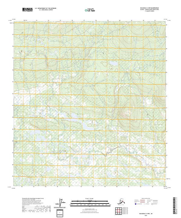
2023 Map of Gulkana C-4 NW
USGS Topo · Published 2023About this map
West Fork Gulkana River winds through the southwestern corner of this interior landscape, defining the primary drainage for a vast wetland system. This area, situated within the Copper River Census Area, is characterized by a dense network of ponds and saturated terrain, documented through data from the FWS National Wetlands Inventory. The map provides a precise layout of the Public Land Survey System, specifically marking the boundaries of t11n r4w, t11n r3w, t10n r4w, and t10n r3w. These survey lines offer a structured look at how this undeveloped region is partitioned for land management and resource oversight, serving as a critical reference for understanding the geography of the Alaska interior.
Find a feature on this map
5 named features on this map. Tap any name to fly to it.
Don’t see what you’re looking for? This feature index may not catch every label — zoom into the map to look around manually.
Map Details
Editions of this 2023 Gulkana C-4 NW Map
This is the sole edition of this map. No revisions or reprints were ever made.
Other maps of this area

1950 · Gulkana D-4
USGS Topo · 1:63,360

1950 · Gulkana C-4
USGS Topo · 1:63,360

1951 · Gulkana
USGS Topo · 1:250,000

1951 · Gulkana D-5
USGS Topo · 1:63,360

1951 · Gulkana C-5
USGS Topo · 1:63,360

1952 · Gulkana D-4
USGS Topo · 1:63,360
1952 · Gulkana D-5
USGS Topo · 1:63,360
1952 · Gulkana C-5
USGS Topo · 1:63,360
1952 · Gulkana C-4
USGS Topo · 1:63,360

1959 · Gulkana
USGS Topo · 1:250,000