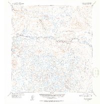
1952 Map of Gulkana C-5
USGS Topo · Published 1953About this map
The West Fork Gulkana River winds through an intricate system of kettle lakes and marshy lowlands in this mid-century topographic study. The landscape is defined by its glacial heritage, where countless unnamed ponds fill the depressions of a complex moraine. Standing above the water-heavy terrain in the southwest corner is Vabm 3129 Brigg, providing a rare high-ground survey point. To the northwest, the drainages of Moose Creek and Key Creek begin their descent toward the river system. This 1952 survey, produced using aerial photographs taken in 1950, records a portion of the Alaska interior entirely devoid of roads or settlements at the time of mapping, highlighting the remote hydrological patterns that dictated early travel and land use in the region.
Find a feature on this map
4 named features on this map. Tap any name to fly to it.
Don’t see what you’re looking for? This feature index may not catch every label — zoom into the map to look around manually.
Map Details
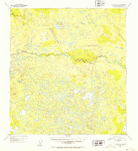
Editions of this 1952 Gulkana C-5 Map
2 editions found
Other maps of this area

1950 · Gulkana D-4
USGS Topo · 1:63,360

1950 · Gulkana C-4
USGS Topo · 1:63,360

1950 · Gulkana B-6
USGS Topo · 1:63,360

1951 · Gulkana
USGS Topo · 1:250,000

1951 · Gulkana D-6
USGS Topo · 1:63,360

1951 · Gulkana B-5
USGS Topo · 1:63,360

1951 · Gulkana D-5
USGS Topo · 1:63,360

1951 · Gulkana C-5
USGS Topo · 1:63,360

1951 · Gulkana B-4
USGS Topo · 1:63,360

1951 · Gulkana C-6
USGS Topo · 1:63,360