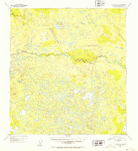
1952 Map of Gulkana C-5
USGS Topo · Published 1953About this map
The West Fork Gulkana River winds through an extensive network of wetlands and kettle ponds in this remote Alaskan interior landscape. Surveyed in the early 1950s using aerial photography, the terrain is characterized by a complex drainage system where Moose Creek and Keg Creek navigate the low-lying areas between glacial landforms. A notable elevation point for surveyors and researchers is marked at VABM 3129 Bragg, providing a primary reference point in a region otherwise dominated by meandering waterways and scattered timber. This map captures the territory before significant modern development, documenting the natural hydrologic patterns of the Gulkana basin.
Find a feature on this map
4 named features on this map. Tap any name to fly to it.
Don’t see what you’re looking for? This feature index may not catch every label — zoom into the map to look around manually.
Map Details
Editions of this 1952 Gulkana C-5 Map
2 editions found
Other maps of this area

1950 · Gulkana D-4
USGS Topo · 1:63,360

1950 · Gulkana C-4
USGS Topo · 1:63,360

1950 · Gulkana B-6
USGS Topo · 1:63,360

1951 · Gulkana
USGS Topo · 1:250,000

1951 · Gulkana D-6
USGS Topo · 1:63,360

1951 · Gulkana B-5
USGS Topo · 1:63,360

1951 · Gulkana D-5
USGS Topo · 1:63,360

1951 · Gulkana C-5
USGS Topo · 1:63,360

1951 · Gulkana B-4
USGS Topo · 1:63,360

1951 · Gulkana C-6
USGS Topo · 1:63,360