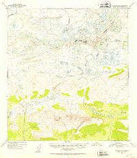
1952 Map of Gulkana D-5
USGS Topo · Published 1953About this map
Tangle Lakes and the sprawling headwaters of the Middle Fork Gulkana River dominate this interior Alaskan landscape as it was mapped in the early 1950s. The survey reveals a complex network of glacial water bodies, including Dickey Lake and the Maclaren River, set against a backdrop of high-elevation terrain. This map captures a significant administrative boundary where the Third Judicial Division meets the Fourth Judicial Division, reflecting the historical legal organization of the territory. The absence of roads or permanent settlements highlights the wilderness character of the region, where named landmarks like Keg Creek and Twin Lakes served as primary orientation points for early surveyors and travelers through the Gulkana watershed.
Find a feature on this map
10 named features on this map. Tap any name to fly to it.
Don’t see what you’re looking for? This feature index may not catch every label — zoom into the map to look around manually.
Map Details
Editions of this 1952 Gulkana D-5 Map
2 editions found
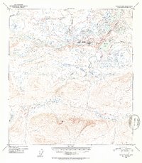
Other maps of this area

1949 · Mount Hayes A-4
USGS Topo · 1:63,360

1949 · Mount Hayes A-5
USGS Topo · 1:63,360

1950 · Mount Hayes
USGS Topo · 1:250,000

1950 · Gulkana D-4
USGS Topo · 1:63,360

1950 · Gulkana C-4
USGS Topo · 1:63,360

1950 · Mount Hayes A-6
USGS Topo · 1:63,360

1951 · Gulkana
USGS Topo · 1:250,000

1951 · Mount Hayes
USGS Topo · 1:250,000

1951 · Gulkana D-6
USGS Topo · 1:63,360

1951 · Gulkana D-5
USGS Topo · 1:63,360