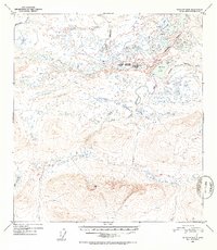
1952 Map of Gulkana D-5
USGS Topo · Published 1953About this map
Middle Fork Gulkana River and the Maclaren River dominate this interior Alaskan landscape, which remains largely devoid of permanent settlements or infrastructure during the mid-century. The intricate hydrologic network is defined by high-elevation water bodies like Dickey Lake and the Tangle Lakes, connected by unnamed tributaries and the meandering Middle Fork. The map documents a strictly natural wilderness, shaped by the Keg peaks and deep drainage basins of Keg Creek and Moose Creek. The presence of the Fourth and Third Judicial Division boundary indicates the administrative partitioning of this expansive territory during the early 1950s, shortly after aerial photography of the region was completed in 1949. This map is a primary resource for understanding the pristine state of the upper Gulkana watershed before modern recreational or resource development.
Find a feature on this map
11 named features on this map. Tap any name to fly to it.
Don’t see what you’re looking for? This feature index may not catch every label — zoom into the map to look around manually.
Map Details
Editions of this 1952 Gulkana D-5 Map
2 editions found
Other maps of this area

1949 · Mount Hayes A-4
USGS Topo · 1:63,360

1949 · Mount Hayes A-5
USGS Topo · 1:63,360

1950 · Mount Hayes
USGS Topo · 1:250,000

1950 · Gulkana D-4
USGS Topo · 1:63,360

1950 · Gulkana C-4
USGS Topo · 1:63,360

1950 · Mount Hayes A-6
USGS Topo · 1:63,360

1951 · Gulkana
USGS Topo · 1:250,000

1951 · Mount Hayes
USGS Topo · 1:250,000

1951 · Gulkana D-6
USGS Topo · 1:63,360

1951 · Gulkana D-5
USGS Topo · 1:63,360