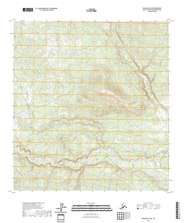
2023 Map of Gulkana C-5 NE
USGS Topo · Published 2023About this map
The Gulkana Wild and Scenic River dominates the southern landscape of this Copper River Census Area terrain. This protected corridor follows the winding path of the West Fork Gulkana River, which meanders through a complex network of wetlands and small ponds typical of the Alaskan interior. The map reveals a high-elevation plateau characterized by the Public Land Survey System designations of t11n r5w, t11n r4w, t10n r5w, and t10n r4w. This specific alignment of topographical and hydrological data illustrates a landscape largely untouched by permanent road infrastructure or concentrated settlements, preserving the natural flow of the glacial-fed waterways. Researchers can trace the river's intricate braided patterns and the surrounding elevation contours that define this protected wilderness reach.
Find a feature on this map
6 named features on this map. Tap any name to fly to it.
Don’t see what you’re looking for? This feature index may not catch every label — zoom into the map to look around manually.
Map Details
Editions of this 2023 Gulkana C-5 NE Map
This is the sole edition of this map. No revisions or reprints were ever made.
Other maps of this area

1950 · Gulkana D-4
USGS Topo · 1:63,360

1950 · Gulkana C-4
USGS Topo · 1:63,360

1951 · Gulkana
USGS Topo · 1:250,000

1951 · Gulkana D-5
USGS Topo · 1:63,360

1951 · Gulkana C-5
USGS Topo · 1:63,360

1952 · Gulkana D-4
USGS Topo · 1:63,360
1952 · Gulkana D-5
USGS Topo · 1:63,360
1952 · Gulkana C-5
USGS Topo · 1:63,360
1952 · Gulkana C-4
USGS Topo · 1:63,360

1959 · Gulkana
USGS Topo · 1:250,000