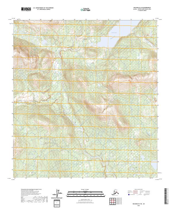
2023 Map of Gulkana D-4 SE
USGS Topo · Published 2023About this map
Paxson serves as the focal point for this interior Alaska landscape, situated at the headwaters where the Gulkana River flows from Paxson Lake. The terrain is characterized by the expansive Gulkana Wild and Scenic River corridor, a critical waterway for navigation and local ecology. A network of historic overland routes, including the Middle Fork Gulkana Trl and the Twelve Mile Creek Trl, underscores the area's importance as a transit corridor through the Copper River Census Area. These trails, along with the Green Cabin Trl, provide evidence of seasonal movement and remote access across the drainage basins of Twelvemile Creek and Gillespie Creek. The map detail captures the specialized infrastructure of the Alaskan wilderness, where watercourses and primitive trails define the geography of the high country.
Find a feature on this map
16 named features on this map. Tap any name to fly to it.
Don’t see what you’re looking for? This feature index may not catch every label — zoom into the map to look around manually.
Map Details
Editions of this 2023 Gulkana D-4 SE Map
This is the sole edition of this map. No revisions or reprints were ever made.
Other maps of this area

1949 · Gulkana D-3
USGS Topo · 1:63,360

1950 · Gulkana D-4
USGS Topo · 1:63,360

1950 · Gulkana C-3
USGS Topo · 1:63,360

1950 · Gulkana C-4
USGS Topo · 1:63,360

1951 · Gulkana
USGS Topo · 1:250,000

1952 · Gulkana D-3
USGS Topo · 1:63,360

1952 · Gulkana D-4
USGS Topo · 1:63,360
1952 · Gulkana C-3
USGS Topo · 1:63,360
1952 · Gulkana C-4
USGS Topo · 1:63,360
1954 · Gulkana D-3
USGS Topo · 1:63,360