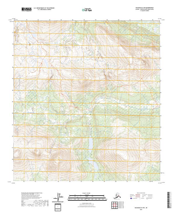
2023 Map of Gulkana D-4 SW
USGS Topo · Published 2023About this map
Alphabet Hills Trl weaves through a landscape defined by high ridges and drainage networks in the interior of Alaska. This survey reveals a wilderness area primarily accessible via traditional routes, with the trail system serving as the primary human footprint across the terrain. To the east, Twelvemile Creek flows through the valleys, accompanied by the Twelvemile Creek Trl, while the Middle Fork - South Trl provides access to the northern reaches. The placement of these paths suggests a reliance on natural corridors for transit through the hills, providing a clear record of backcountry navigation and land use prior to more intensive development.
Find a feature on this map
12 named features on this map. Tap any name to fly to it.
Don’t see what you’re looking for? This feature index may not catch every label — zoom into the map to look around manually.
Map Details
Editions of this 2023 Gulkana D-4 SW Map
This is the sole edition of this map. No revisions or reprints were ever made.
Other maps of this area

1950 · Gulkana D-4
USGS Topo · 1:63,360

1950 · Gulkana C-4
USGS Topo · 1:63,360

1951 · Gulkana
USGS Topo · 1:250,000

1951 · Gulkana D-5
USGS Topo · 1:63,360

1951 · Gulkana C-5
USGS Topo · 1:63,360

1952 · Gulkana D-4
USGS Topo · 1:63,360
1952 · Gulkana D-5
USGS Topo · 1:63,360
1952 · Gulkana C-5
USGS Topo · 1:63,360
1952 · Gulkana C-4
USGS Topo · 1:63,360

1959 · Gulkana
USGS Topo · 1:250,000