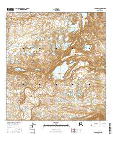
2016 Map of Gulkana D-5 NE
USGS Topo · Published 2016About this map
Paxson serves as the primary landmark on this interior landscape, where the high-altitude terrain is defined by its complex drainage systems. The northern portion of the sheet is dominated by the Tangle River, which flows through a series of kettle lakes and marshy lowlands before the elevation rises sharply toward the south. Central to this region is Dickey Lake, a significant water body that feeds into the headwaters of the Middle Fork Gulkana River. This hydrographic pattern illustrates the transition between distinct watershed basins, an area where the movement of water dictates the geography. Surveyed in 2016, the map records the enduring configuration of these remote glacial landforms, showing how local hydrology continues to shape the region long after the initial establishment of road-stop settlements like Paxson.
Find a feature on this map
10 named features on this map. Tap any name to fly to it.
Don’t see what you’re looking for? This feature index may not catch every label — zoom into the map to look around manually.
Map Details
Editions of this 2016 Gulkana D-5 NE Map
This is the sole edition of this map. No revisions or reprints were ever made.
Other maps of this area

1949 · Mount Hayes A-4
USGS Topo · 1:63,360

1949 · Mount Hayes A-5
USGS Topo · 1:63,360

1950 · Mount Hayes
USGS Topo · 1:250,000

1950 · Gulkana D-4
USGS Topo · 1:63,360

1951 · Gulkana
USGS Topo · 1:250,000

1951 · Mount Hayes
USGS Topo · 1:250,000

1951 · Gulkana D-5
USGS Topo · 1:63,360

1952 · Gulkana D-4
USGS Topo · 1:63,360

1952 · Mount Hayes A-4
USGS Topo · 1:63,360
1952 · Gulkana D-5
USGS Topo · 1:63,360