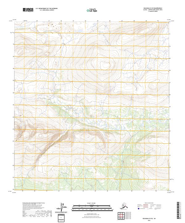
2023 Map of Gulkana D-5 SE
USGS Topo · Published 2023About this map
The high-latitude landscape of the t12n r4w and t13n r4w townships dominates this interior Alaskan terrain. Characterized by significant elevation changes and glacial drainage patterns, the area features the distinctive Twin Lakes on its eastern edge, positioned within the t12n r4w section. This 2023 survey by the U.S. Geological Survey documents the topographical relief and township boundaries including t11n r5w and t13n r5w, reflecting the vast, unsettled character of the Copper River Census Area. The lack of roads or structures emphasizes the wilderness state of this corridor north of the Gulkana region.
Find a feature on this map
7 named features on this map. Tap any name to fly to it.
Don’t see what you’re looking for? This feature index may not catch every label — zoom into the map to look around manually.
Map Details
Editions of this 2023 Gulkana D-5 SE Map
This is the sole edition of this map. No revisions or reprints were ever made.
Other maps of this area

1950 · Gulkana D-4
USGS Topo · 1:63,360

1950 · Gulkana C-4
USGS Topo · 1:63,360

1951 · Gulkana
USGS Topo · 1:250,000

1951 · Gulkana D-5
USGS Topo · 1:63,360

1951 · Gulkana C-5
USGS Topo · 1:63,360

1952 · Gulkana D-4
USGS Topo · 1:63,360
1952 · Gulkana D-5
USGS Topo · 1:63,360
1952 · Gulkana C-5
USGS Topo · 1:63,360
1952 · Gulkana C-4
USGS Topo · 1:63,360

1959 · Gulkana
USGS Topo · 1:250,000