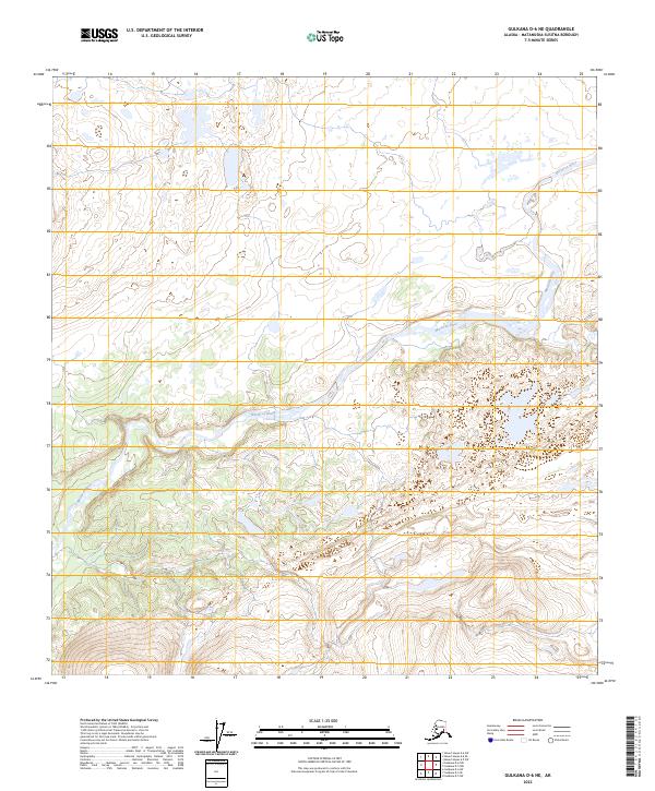
2023 Map of Gulkana D-6 NE
USGS Topo · Published 2023About this map
Maclaren River dominates this interior Alaskan landscape, winding through a complex system of glacial outwash plains and kettle lakes. This high-altitude drainage basin, located within the Matanuska-Susitna Borough, reveals the intricate relationship between the braided river system and the surrounding wetlands. The lack of named settlements or infrastructure highlights the wild character of the Gulkana region, where the terrain is primarily defined by the movement of water and the undulating elevations of the Alaska Range foothills. Surveyed boundary lines for townships such as t14n r7w and t13n r8w provide the only formal human overlay on this remote river valley, offering a precise view of the Public Land Survey System's reach into the northern wilderness.
Find a feature on this map
7 named features on this map. Tap any name to fly to it.
Don’t see what you’re looking for? This feature index may not catch every label — zoom into the map to look around manually.
Map Details
Editions of this 2023 Gulkana D-6 NE Map
This is the sole edition of this map. No revisions or reprints were ever made.
Other maps of this area

1949 · Mount Hayes A-5
USGS Topo · 1:63,360

1950 · Mount Hayes
USGS Topo · 1:250,000

1950 · Mount Hayes A-6
USGS Topo · 1:63,360

1951 · Gulkana
USGS Topo · 1:250,000

1951 · Mount Hayes
USGS Topo · 1:250,000

1951 · Gulkana D-6
USGS Topo · 1:63,360

1951 · Gulkana D-5
USGS Topo · 1:63,360
1952 · Gulkana D-6
USGS Topo · 1:63,360
1952 · Gulkana D-5
USGS Topo · 1:63,360

1952 · Mount Hayes A-6
USGS Topo · 1:63,360