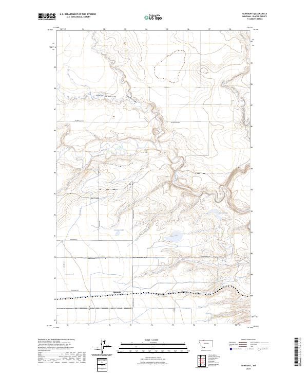
2024 Map of Gunsight
USGS Topo · Published 2024About this map
Gunsight sits as the primary settlement in this stretch of Glacier County, situated among a landscape defined by dramatic drainage patterns and small prairie lakes. The winding course of Cut Bank Creek carves through the central terrain, flanked by significant geographical markers like South Fork Little Rock Coulee and Big Rock Coulee. This 2024 survey documents the modern layout of rural infrastructure, where established routes such as Ed Williams Rd, Henderson Rd, and Pendergrass Rd provide access to water features including Allison Lake, Conway Lake, and Hope Lake. The presence of the Q Lateral irrigation feature indicates the managed water system vital to this high plains environment, while the strictly gridded township boundaries underscore the enduring influence of the Public Land Survey System on the Montana landscape.
Find a feature on this map
24 named features on this map. Tap any name to fly to it.
Don’t see what you’re looking for? This feature index may not catch every label — zoom into the map to look around manually.
Map Details
Editions of this 2024 Gunsight Map
This is the sole edition of this map. No revisions or reprints were ever made.
Other maps of this area

1907 · Blackfoot Res.
USGS Topo · 1:48,000

1909 · Cut Bank
USGS Topo · 1:125,000

1911 · Blackfoot
USGS Topo · 1:125,000

1912 · Cut Bank
USGS Topo · 1:125,000

1960 · Cut Bank
USGS Topo · 1:250,000

1963 · Cut Bank
USGS Topo · 1:250,000

1964 · Cut Bank
USGS Topo · 1:250,000
1966 · Cut Bank
USGS Topo · 1:24,000
1966 · Cut Bank SE
USGS Topo · 1:24,000
1966 · Squaw Buttes
USGS Topo · 1:24,000